

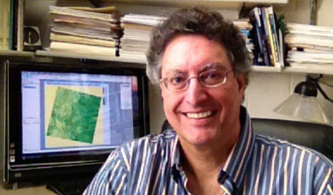
Dr. James Lein
Dr. James Lein, Professor of Geography, is retiring after 31 years of quality teaching, research and service contributions to the Geography Department.
“Jim’s main areas of expertise are the geospatial techniques, especially remote sensing and Geographic Information Systems (GIS), quantitative methods, environmental hazards, and environmental impact analysis,” says Dr. Dorothy Sack, Professor and Chair of Geography. “During the course of his career he has made numerous significant contributions to the mission of the university and the profession, and has advanced knowledge in meaningful ways that have benefited society.” That includes serving as principal investigator or co-PI on $5 million in research grants.
“Through his research, Jim has helped advance knowledge in geotechnical fields that have become increasingly important for national security, resource assessment, environmental impact analysis, analysis of environmental change at multiple scales, and exploration of other planets,” Sack adds. “Through his teaching and graduate student mentoring, he has helped to educate subsequent generations of professionals who will advance knowledge and understanding even further.”
Lein was responsible for establishing the geospatial techniques of GIS and satellite remote sensing at Ohio University—and for fully integrating these critical topics into the geography curriculum. He will continue to teach remote sensing each spring on the early retirement program.
“As the technology used in those fields has grown and evolved, so has Jim’s knowledge and expertise, and he continues to remain at the cutting edge of the latest developments,” notes Sack. “He is also responsive to student needs and interests. For example, one of his recent course offerings concerned collecting and analyzing geospatial data using remotely controlled aerial vehicles (UAVs, or drones).”
Dr. James Lein
Lein has a commanding presence in the classroom. He has supervised a combined 45 master’s students from geography and environmental sciences, and his graduate students have gone on to doctoral programs and successful careers in academia, government agencies, and various companies related to the remote sensing, GIS, and environmental fields.
Over the last 31 years, Lein has published 50 peer-reviewed articles, five book chapters, and four single-authored books, including one on artificial intelligence. He has given 91 conference presentations and numerous invited research talks. He has actively involved graduate students in coauthoring presentations and peer-reviewed journal articles. And he has held important leadership roles in a consortium of state institutions (Ohio View) that, with support from NASA, shared knowledge and facilitated widespread access to geotechnical software and imagery. He also served in major leadership roles in professional remote sensing and applied geography societies.


Comments