
Editor’s Note: The Happy Beginnings series features recent College of Arts & Sciences graduates who are getting started in careers, graduate school and service.
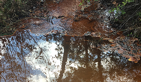
Two Ohio University alumni are back as grad students, helping an interdisciplinary team—Ohio University’s Appalachian Watershed Research Group—assess data collected from regional mining operations in a first-of-its-kind study to better predict how groundwater levels will respond to mining.
The research group has pulled together a team from Geological Sciences and the Voinovich School of Leadership and Public Affairs’ Environmental Studies program to create a geospatial tool to model potentially negative environmental impacts from mining operations in the future.

Rebecca Steinberg
Alum Rebecca Steinberg ’17, a student GIS Technician on the mine-pool project, finished her first round of education at Ohio University with an undergraduate geology major and a GIS certificate.
“I was the kid with the random collection of rocks,” Steinberg said. An Athens native, she decided to pursue geology in undergraduate because of its basis as the structure of the rest of the environment.
Now a first-year master of environmental studies candidate at Ohio University’s Voinovich School, Steinberg’s multidisciplinary education is exemplary of the mine-pool team’s diverse experiences in acid mine drainage issues.
“I’m on the GIS side of the project, but I know the geology,” Steinberg said.

Zachary Matthews
She and fellow MSES student Zachary Matthews ’17 work specifically on managing the large amounts of data collected for the team’s eventual map-based tool. Matthews studied archeology as an Anthropology undergraduate, also at Ohio University, where he explored the surrounding region in the university’s Field School in Ohio Archeology.
“I just really liked being outside – every day was pretty exciting, not knowing what you were going to find,” Matthews said of his passion for outdoor fieldwork.
After a year-and-a-half of traveling the country for contract work, Matthews decided to return to his alma mater and pursue a graduate GIS certificate. He enrolled as an MSES candidate and joined the mine-pool project in the fall of 2017.
Together Steinberg and Matthews are organizing enormous amount of data – combing through hundreds of thousands of pages of mining permits and reports collected by ODNR – and entering it into an online database. Here, the MSES duo are looking for ‘useable’ data points – well and borehole coordinates, static water levels, and total depth of wells – for the later analysis and modeling aspects of the project’s monitoring tool creation.
In addition to data entry and processing, Steinberg has also been the primary person for projecting data into files for GIS ArcMap – ultimately the way in which the GIS-based mine pool monitoring tool will be constructed as the team’s final product.
Quality assurance is also an important task for the project’s completion. The data management team diligently compares the entered data to the original ODNR permits, checking for patterns of error and correcting their spreadsheets accordingly.
“This process is meant to ensure consistency and correctness of all of our entered data,” Matthews said.
- Read the rest of the story at “Appalachian Watershed Research Group mines data in unique study to protect water quality in southeast Ohio.”


Comments