
Students developed forecasts to plan their daily expeditions in search of storms.
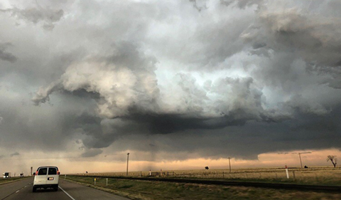
The group races east toward a supercell in the Texas panhandle, attempting to get ahead of the forward flank downdraft.
Eighteen meteorology students from Ohio University packed their bags and headed west to the Central and Southern Plains’ Tornado Alley.
On the trip, students directly observed deep, moist atmospheric convection and its associated phenomena, including single-cell, multi-cell, and supercell storms, which can produce squall lines, hail, lightning, and tornadoes. The 15 undergraduate and three graduate students were a record for the 2018 Field Studies of Convection course in May.
The Ohio University course was featured June 18 in US News & World Report headlined “Tornado Tourism Booms Despite Storm Season.” Check out the awesome photos of the OHIO students!
Jana Houser, an assistant professor of meteorology at Ohio University, leads one of just a few storm chasing programs currently available at universities and takes students into the field for an interactive experience each summer….
Houser also suggests an app called Radarscope, which she says “is nice because it gives high-resolution radar data to your cellphone, and it’s relatively inexpensive and tied in to a couple of other networks that are going to show storm chaser locations, give lighting information, storm tracks, storm reports from chasers who are actually out there.”
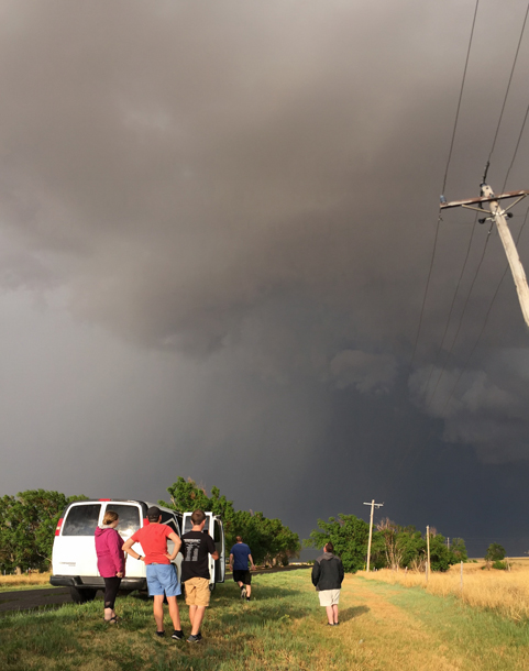
A hail shaft from a supercell in the Oklahoma panhandle stopped the group in its tracks, but was still a great opportunity for photos.
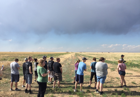
Students stopped to check out a low precipitation supercell that had fired in northeast New Mexico, which the group affectionately named “Larry” before the updraft collapsed.
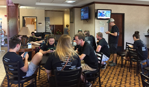
Students wait eagerly in a hotel lobby as a new outlook from the Storm Prediction Center was being issued.
Making the Right Forecast—Or Missing the Storm
Each day began bright and early, with a full weather briefing led by Dr. Jana Houser, Assistant Professor of Geography, or by students who had volunteered. Everything from surface analyses, upper air soundings, mesonets, satellite and radar images, and multiple weather models were used to diagnose the best regions for the most severe storms that day.
“I’d say the most difficult part of forecasting was figuring out how much to trust the weather models. There were a couple days where we could only rely on current observations and soundings,” said Austin Patrick, a senior Meteorology major.
Discussions often broke out before, during and after the briefings, as student used their knowledge and experiences to create their forecast. With all the information laid before them, the sometimes-difficult decision had to be made for where to target and when.
Any errors would mean a missed opportunity at the best storms that day—or the worst-case scenario, no storms at all.
“Students also get to experience the consequences of their forecasts and decisions-both good and bad. There is truly no better way to learn!” Houser said.
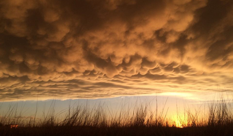
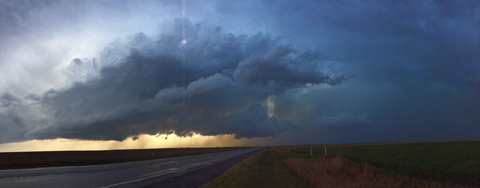
A squall line in the Texas panhandle.
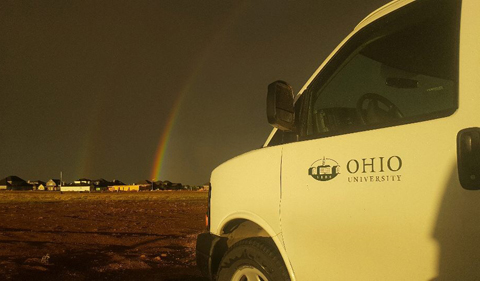
A passing squall line in the Texas panhandle near dusk made for excellent photos of the mamatus clouds to the west, and a brilliant rainbow to the east.
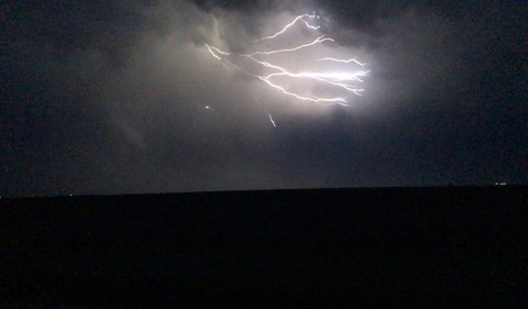
After ending the chase for the day, the group was treated to a light show from an a developing squall line in central Kansas.
Classroom to Convection
Once the decision was made, vans were packed and ready to roll from that night’s hotel, with drives between two to eight hours needed to get into position.
Cutting across rural county roads and highways in Colorado, Kansas, Oklahoma, and Texas was common, passing by wide-open crop fields, pasture land, and wind farms that stretched for miles on end. Time was also spent at gas stations in small towns, carefully watching the atmosphere as it destabilized during the day and recording events in weather journals.
“The trip gave me insight into the reality of how difficult field research campaigns can be. Moving from town to town, eating fast food, and running off of only a few hours of sleep,” said Meteorology senior Connor Belak.
Waiting turned to excitement when convection began, and the students could watch storms unfold before their eyes. Once the storms had finished for the day, or it became too dark, the group returned to a hotel for the night, to repeat the process the next day.
“One fantastic aspect the Field Studies of Convection program is that it allows students to take the knowledge that they’ve been gathering in the classroom and apply it to real-world, fast-paced, meteorological events,” says Christine Aiena, a Meteorology graduate student and assistant director of the course. “Additionally, this field campaign forces students to synthesize concepts that they have learned from multiple courses and semesters in order to fully understand what is happening at different levels of the troposphere.
“This unique course is a once-in-a-lifetime experience that submerges students and faculty in radar, mesoscale, and synoptic meteorology!” she adds.
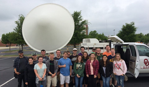
Before returning to Ohio, the group was able to visit the National Weather Center at the University of Oklahoma, along with a tour of the RaXPol mobile radar truck.
The eight-day trip was hosted through the Office of Global Opportunities and led by Dr. Jana Houser, Assistant Professor of Geography.
“The main goal of this trip is to have students be completely immersed in the world of severe storms meteorology, having daily opportunities to apply topics taught in the classroom about storm structure and forecasting to real-life scenarios” Houser says.


Comments