
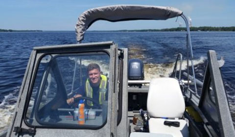
James Fox during his summer internship with the USGS
By James Fox ’18
Senior Geological Sciences major
I was fortunate to spend the past summer as a Pathways Intern for the U.S. Geologic Survey investigating water quality issues.
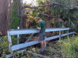
While interning for the USGS in the Pathways Internship Program, I was introduced to a broad spectrum of projects and tasks. This sometimes included office work, where I would make copies for the staff or organize a filing room and warehouse to standing in a swamp with an alligator 15 feet away while trying not to move so my equipment could calibrate correctly.
Joining a Government Agency
The U.S. Geological Survey, a subset of the Department of Interior, is a federal agency that studies the landscapes, natural resources, and natural hazards within the United States. The U.S. Geological Survey is known as the largest water, earth, biological science, and civilian mapping agency in the nation. More specifically the Water Division focuses their efforts on studying water resources, such as water availability and use, national water quality, as well as groundwater and stream flow information.
The Caribbean-Florida Water Science Center of the USGS, located in Orlando, FL, is one of the 48 science centers operated by the USGS across the nation. The collection and analysis of hydrologic investigations and water resource studies are the main focus of the CFWSC. The data that is collected and distributed is often used to understand water resource issues and questions that the nation might have. The fact that the data is unbiased in all regards supports the credibility of the CFWSC.
The Importance of Water
Stream flow and water quality data are often used as a general staple for hydrologic information. As an intern working alongside Hydrologic Technicians and Hydrologists at the CFWSC, I was able to gather information using the methods applied by the USGS and analyze the data to be forwarded to publication. These publications are then made public and are often then used at a local or state level to derive water distribution amounts per community and water quality legislation. This legislation goes on to affect various fields such as environmental consulting, construction, and agriculture to name a few.
While interning for the USGS in the Pathways Internship Program, I was introduced to a broad spectrum of projects and tasks. Many days included going into the field to collect stream flow data with a partner. This may have been done standing on a bridge or wading in the water, maneuvering a kayak, or driving an 18-foot long coast guard boat. I learned quickly that being in the field requires you to be technically savvy, creative, and patient if your instruments need fine-tuned or repaired.
Combining Internship and Classroom Skills
Some of the experiences were more thrilling than others yet all were fundamentally important when it came to gaining the knowledge it takes to become a productive and credible employee and scientist. Overall the opportunity that the USGS has given me has been like no other. Being able to apply the skills from my classes to the internship or vice versa has been more than helpful when it comes to succeeding in either. In total, this opportunity has shown me what the government sector has to offer in my field, a network to further my career, and the attributes it takes to collect quality data as a scientist.


Comments