
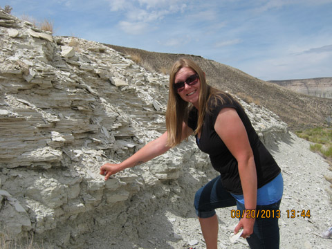
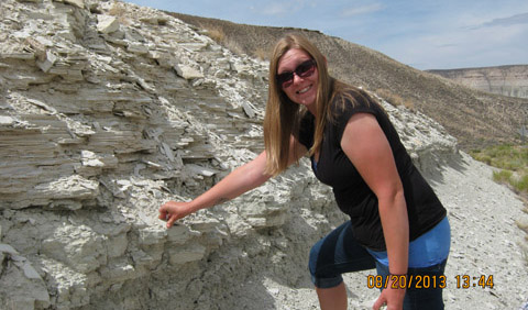
Audrey Blakeman studying freshwater limestone in the Great Green River Basin in Wyoming.
Audrey A. Blakeman, a Geological Sciences graduate student at the Ohio University, presented a poster May 2014 at the Joint Rocky Mountain/Cordilleran Section Meeting of the Geological Society of America.
Her poster, co-authored by her adviser, Dr. Elizabeth Gierlowski-Kordesch, Professor of Geological Sciences, was on “Carbonate Lake Deposits in the Fluvial Bridger Formation of the Greater River Basin, Wyoming.”
Abstract: The Bridger Formation of Eocene age is the uppermost fluvial unit exposed in the lacustrine Greater Green River Basin (GGRB) of southwestern Wyoming. The distribution of facies has only recently been addressed in detail through chronology (dating of ash layers), sedimentology, and geochemistry. However, the connection of the fluvial sediments of the Bridger, interpreted as the floodplain associated with the southern margin of Lake Gosiute, with the main lake sequence in the central part of the GGRB is still unclear.
Unit B of the Bridger Formation has been correlated with the lacustrine Laney Member of the Green River Formation to the north; the Laney Member represents the final, overfilled stage of Lake Gosiute. The Bridger Formation is characterized by thick sequences of siliciclastic mudstones, sandstones, and thin limestones; the source of these thick mudstones is interpreted as eroded volcanic sediments carried into the GGRB from the south, originally sourced from volcanic episodes in the Absaroka and Challis volcanic fields to the north. Bridger limestones have been interpreted previously as transgressive lake deposits linked to the Laney Member. Field study in the central portion of the Devil’s Playground Quadrangle (WY) supports a different conclusion: limestones instead were deposited in the interchannel flood basins of an anastomosing river system containing Ca-rich waters that fed into Lake Gosiute.
The stratigraphic interval studied in the Bridger B included the Golden Bench Limestone and five unnamed or undocumented limestone units immediately above and below it. These limestone bodies are not laterally continuous and vary in thickness from approximately 10 to 53 cm. They abruptly appear and pinch out over distances of less than half a mile, and commonly are replaced by new limestone bodies within two meters above or below, giving the impression of lateral continuity from aerial photographs. Limestones of the Bridger B are clearly not laterally continuous to the north, indicating that these units were not deposited within Lake Gosiute as it transgressed. Stratigraphy and paleoenvironmental interpretation of the Bridger Formation need to be re-assessed.


Comments